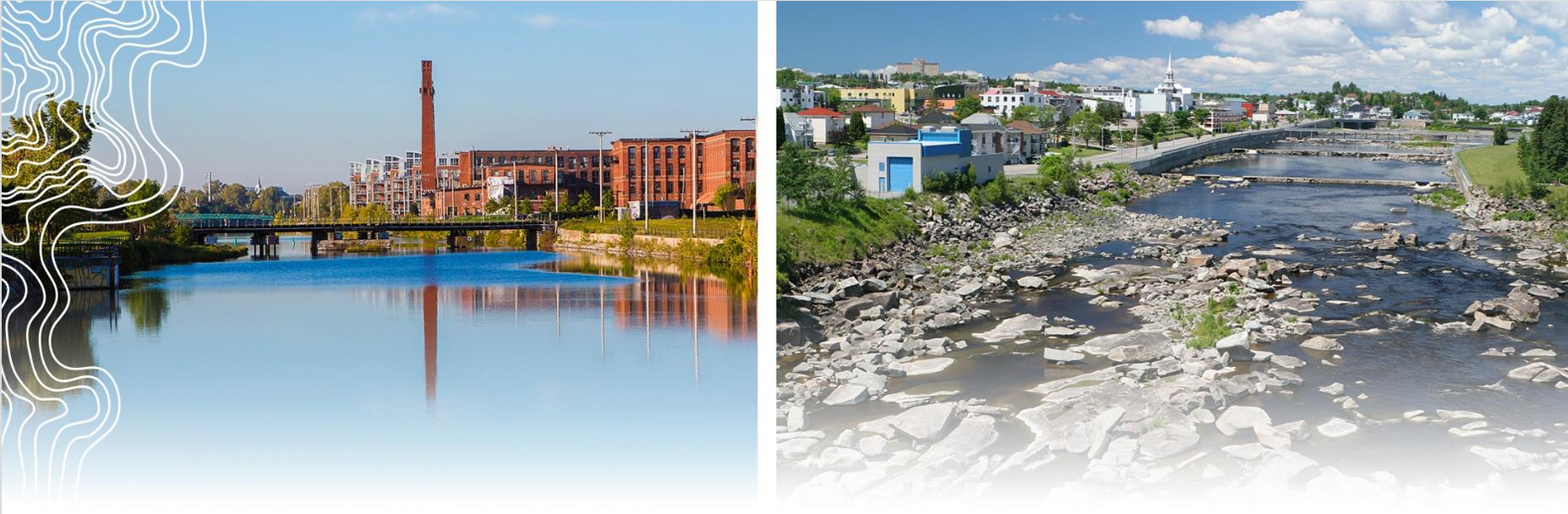
Turning the Tide: How Québec Is Building Resilience Against Floods
Turning the Tide: How Québec Is Building Resilience Against FloodsAs flooding events become more frequent and severe, Québec has taken decisive action to protect its communities and ecosystems. After the devastating floods of 2017 and 2019, the Government of Québec launched the Territory protection plan against flooding – a comprehensive framework to strengthen resilience, manage water risks, and integrate climate change into land-use planning. Extended until 2028, it embodies science-based governance and collaboration across sectors and levels of government.
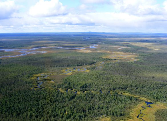
Covering over 1.6 million km², with 22% of its surface covered by rivers and lakes, Québec is highly exposed to flooding. Climate change has led to warmer winters, increased precipitation, and more frequent extreme rainfall. To address this, the province created the Territory protection plan against flooding in 2020 through the Ministerial action group on land use planning and floods, in partnership with municipalities and scientists. With an initial budget of CAD 479 million, over half of its 23 measures have already been completed. The latest update (July 2025) reaffirms a long-term vision built around four Axes of Action:
1. Mapping flood zones with science-based tools
Flood mapping is being modernised through a province-wide, watershed-based approach that integrates hydrological, historical, and climate data. Whereas municipalities previously produced their own maps using varying methodologies, this responsibility now rests with the provincial government, which applies a uniform method updated regularly in line with scientific and technological advances.
Supported by the INFO-Crue project, which provides advanced hydrological data and modelling, and by municipal organisations funded by the Ministry of Municipal Affairs and Housing (MAMH), the new maps are progressively made public on Québec.ca/zonesinondables portal. The portal features the interactive Géo-Inondations map, which compiles areas covered by previous generations of flood mapping, offering a clear visual reference for citizens, municipalities, and professionals. Through this portal, users can visualise flood exposure across the territory and access up-to-date information to support informed decision-making.

The Géo-Inondations map: an official information source that allows users to easily check whether a property is located in a flood-prone area.
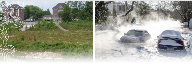
2. Regulating and guiding development in risks zones
A new regulatory framework, adopted in June 2025 and entering into force in March 2026, harmonises standards for construction and development in floodplains across Québec. It aims to strengthen the resilience of buildings and communities, protect ecosystems, and ensure coherent floodplain management throughout the province. While establishing uniform principles, the framework also allows local governments the flexibility to adapt land-use planning to their specific territorial and environmental conditions.
3. Planning and acting for resilient communities
At the local level, the Flood Resilience and Adaptation Programme (PRAFI) invests CAD 442 million over five years to support municipalities in creating project offices, upgrading infrastructure, promoting climate-resilient land-use, and assisting voluntary relocations from high-risk zones. PRAFI marks a shift from reactive emergency response to proactive, community-led adaptation.
4. Improving knowledge and communication
The plan’s final axis focuses on strengthening knowledge and communication to improve understanding of floods, enhance river monitoring, and make information more accessible to both citizens and decision-makers. It expands hydrological monitoring networks, enhances geospatial data collection, and compiles an inventory of protective infrastructure. Public awareness is a central pillar of this approach. Tools such as Géo-Inondations map and the Vigilance portal provide open access to information on flood risks and real-time forecasts, enabling citizens and authorities to better anticipate and respond to events. These tools will continue to evolve ahead of the implementation of the new regulatory framework in 2026.
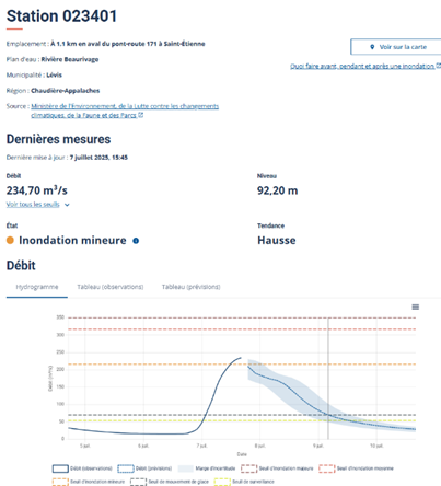
The Vigilance portal provides real-time data and flood forecasts, helping communities track evolving conditions and better prepare for upcoming events
Partnerships with universities, research institutions, and municipal training initiatives help ensure that knowledge is shared effectively and that planning and decision-making remain firmly grounded in evidence and science.
By combining cutting-edge mapping, clear governance, and local support, Québec’s flood management plan is shaping a model of adaptive and science-based territorial governance. It demonstrates how subnational governments can lead comprehensive resilience strategies that protect lives, ecosystems, and economic stability in a changing climate.

More information:
About #RegionsVoice: In 2019, Regions4 launched the global campaign #RegionsVoice in a collective effort to bring the voice of regional governments to the major events and negotiation processes in sustainable development within the UN. The aim of the campaign is to ensure the visibility and wider recognition of the role of regional governments in sustainable development, by elevating both individual and collective messages and engaging with a wider audience during the UN Decade of Action.
Visuals courtesy of the Government of Québec and the Territory Protection Plan Against Flooding.
More actions in this region
- 5 million CAD invested annually

Direct Health Assistance
Québec, Canada The government of Quebec provides direct health assistance to its population- Climate Monitoring

Ecological Connectivity and Climate Transition in Quebec
Québec, Quebec Ecological Connectivity and Climate Transition in Quebec As North America’s climate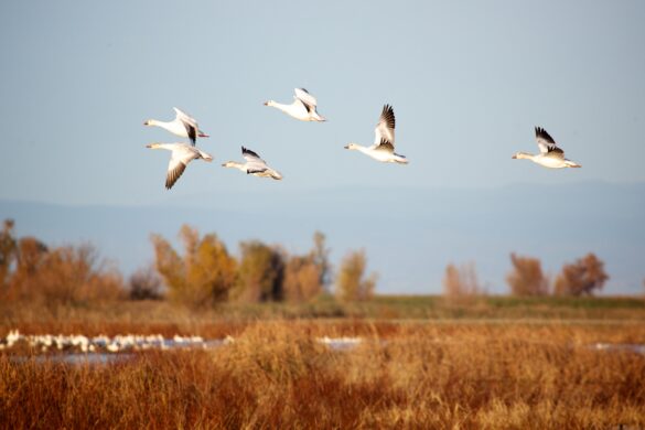
Multidisciplinary Hub of Expertise on the Sustainable Management of the Littoral Zone of Lake Saint-Pierre in Québec
Québec, Canada The United Nations General Assembly has declared the UN Decade on- A network of 450 researchers, experts, practitioners, and decision-makers

Planning and implementing Québec’s adaptation to future climate
Québec, Canada Relying on solid scientific knowledge to take into account the future- Climate Monitoring

Preparing for the future: How Québec’s Biodiversity Monitoring Network tackles environmental change
Québec, Canada Preparing for the future: How Québec’s Biodiversity Monitoring Network tackles environmental
Putting Communities at the Heart of Conservation in Québec
Québec, Quebec Delivering 30×30: Regions turning global biodiversity commitments into coordinated territorial action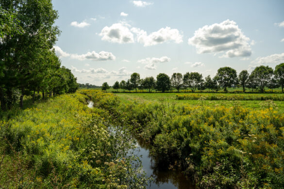
Québec Ecological Corridors: supporting resilience against climate change and biodiversity loss
Québec, Canada Through the Québec Ecological Corridors Initiative Québec province is using nature-based- 161,540 km2 of protected territory
Quebec’s network of protected areas
Québec, Canada The network of protected areas of land and freshwater covers 10.65%- 5560 observations of IAS published
Sentinelle
Québec, Canada Online tool for detecting invasive alien species Quebec is Canada’s largest- Climate Monitoring
